Breadcrumbs
HomeAerial Photographs from 1949
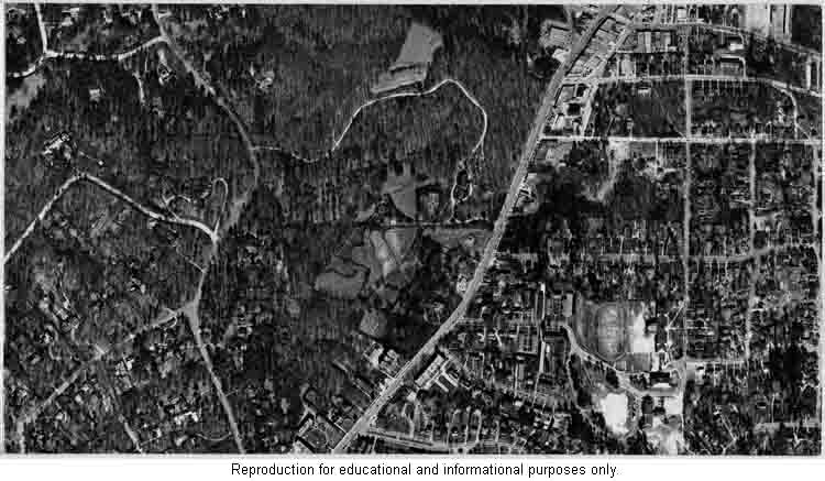 When you take off from Hartsfield-Jackson Airport and see the rim of lavender smog that lines the horizon on summer days, it makes you wonder what Atlanta was like 60 years ago. The Georgia State University Library has posted aerial photographs taken of our city's neighborhoods in 1949. There is an index map that shows a grid of the photographs taken. You simply click on an area of interest on the map and it will take you to the corresponding photograph for that section of the city. Once the small photograph loads, you can click to a larger image for greater detail, although this image may take longer to load.
Urban Heat Island (Deforestation)
 A You Tube video with images of aerial views of heat maps of Atlanta over time, showing the deforestation of Atlanta, and how this alters weather patterns, causes more heat, pollution and smog.